
Early September, and the sun is baking down. When I say baking, think of 180 degrees in an oven. Ja! That kind of baking.
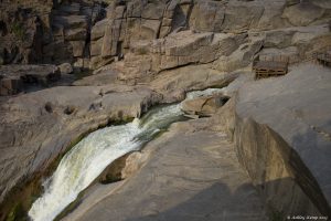
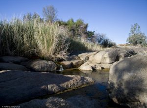
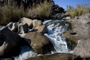
Hot and dry as we make our way along the boardwalk, but ahead is the surprising sound of gushing water and you can detect a faint hint of moisture as the breeze shifts.
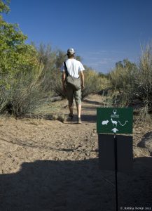
The boardwalk links various wooden viewing decks, where there are people peppered about, some taking photographs and others just absorbing the sight in front of them.
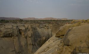
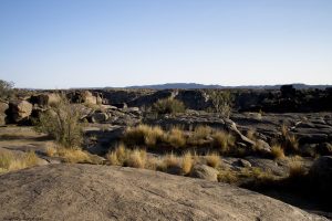
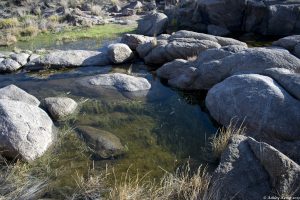
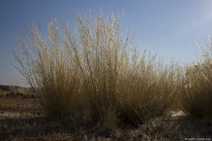
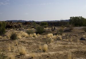
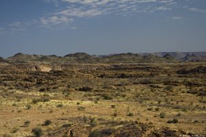
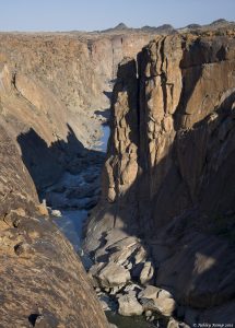
In scenery so harsh and bleak looking as this, with scarred rocks and limited vegetation, the idea of finding water comes as a pleasant surprise.
But the idea of finding LOTS of water is completely gobsmacking.
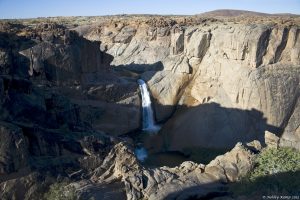
So when you make your way to a deck and find a rock gorge with a 54 meter waterfall plummeting down the rock face, you’re bound to be suitably impressed.


Welcome to the Augrabies Falls National Park, and more specifically (seeing as the park is fifty five thousand odd hectares) the main attraction, The Augrabies Falls.

People say it’s indescribable, but to be honest, I don’t agree.
It is describable to anyone who knows what magical power the sight of volumes of moving water can have, to people who love natural places and those who like to sit quietly and soak up the richness nature has to offer, they’ll understand. As will those who like to watch the ever changing movement of the falls, the way the spray is affected by the breeze, to see the swallows dip and play in the spray and to see the awe stuck faces of the people whose first visit it is.
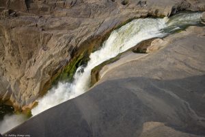
The name we use today is derived from the Nama word “Aukoerebis”, meaning the place of great noise. How apt and descriptive the Khoisan were with naming.
Apparently “Augrabies” is the interpreted name the Swedish explorer Hendrik Jakob Wikar heard and documented when he was describing the life of the Khoisan in his journal in the late seventeen hundreds.
The Orange River which flows through the park starts in the Drakensberg mountains in Lesotho, (called the Senqu river in Lesotho) flowing westwards through South Africa to the Atlantic Ocean. The river forms part of the international borders between South Africa and Namibia and between South Africa and Lesotho. Except for Upington, (120kms East of the Park) it does not pass through any major cities. The Orange River plays an important role in the South African economy by providing water for irrigation, as well as hydroelectric power.

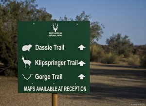
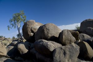
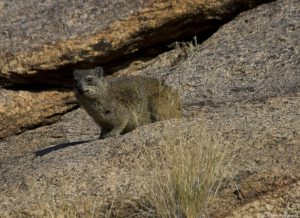
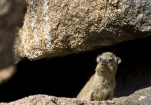
There are only three hiking trails in the park. The Klipspringer Hiking Trail, which is a 3 day, 2 night trail, and only doable in the cooler months (April – September) due to the heat. The Gorge trail, which takes you up to Arrow Point and gives you a great view up the gorge. And the Dassie trail, which is a circular route of about 5 milometers, and shows off a lot of the parks diverse scenery and some interesting sights, besides the abundant Dassies.
Take a look for yourself:
Personally I wouldn’t say go all that way just to see the park. (it’s pretty much a long way from anywhere) For me, making it a stopover on your way elsewhere is a great idea.
3 Comments. Leave new
I don’t think you should be allowed to take a camera to magical places like this. You’ve done it far more than justice, and shown us all what we should look forward to when we travel with open eyes and open minds. This is beautiful, and makes me truly envious. Thank you for a wonderful record.
We drove there on our honeymoon in 2011. We were lucky to see the falls with historically high water flow; a few of the walkways even got washed away. I’ll have to dig out some photos of the falls for my photo blog; thanks for bringing back the memory.
That’s so awesome! Must have been a superb sight to see. Thanks for the comment.